Cruising Sailors Forum Archive
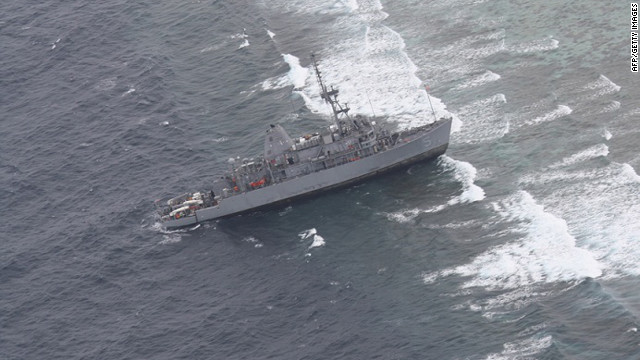
I'll bet the skipper of the Navy minesweeper GUARDIAN wishes they'd been using paper back in January... 
In Response To: I've read that the military isn't using paper anymore ()
Hey Larry,
He and 3 others have recently been relieved of their command...
"A digital chart used by the minesweeper Guardian to navigate Philippine waters misplaced the location of a reef by about eight nautical miles, and may have been a significant factor when the ship drove hard aground on the reef on Jan. 17.
As of Jan. 18, Navy ships have been directed to "operate with caution" when using similar electronic charts and compare the map data with paper charts, which are considered accurate."
http://www.navytimes.com/article/20130119/NEWS/301190305/Digital-map-error-may-have-led-to-grounding
best regards,
Jon

Messages In This Thread
- What will I do with all the free space in my chart drawer, now that I have an Ipad?


- iPad all - Garmin Bluechart

- Here are the ones we use for navigation
- Well, maybe not....
- It's funny to hear the CG these days say, "Do you have a cell phone?"


- Maybe I'm old fashioned....
- Also old fashoned
- A handheld GPS is a good investment
- Me 3
- Hand held GPS, which got me across the gulf of Mexico twice and all through the Bahamas, paper charts
- Sounds like you're using them. Truth is, I haven't penciled a bearing, drawn a course/speed line, in years.


- I've read that the military isn't using paper anymore
- Cruise ships still use paper...
- I'll bet the skipper of the Navy minesweeper GUARDIAN wishes they'd been using paper back in January...

- Paper Charts
- Almost took up drafting mid life. Wanted to draw on my past experiences but the details were too sketchy..


- I've read that the military isn't using paper anymore
- Sounds like you're using them. Truth is, I haven't penciled a bearing, drawn a course/speed line, in years.
- It's funny to hear the CG these days say, "Do you have a cell phone?"
- iPad all - Garmin Bluechart